Detailed depth contours. More confidence offshore.
SeaDepth Charts, also known as Sea Depth Charts, brings the bottom into focus. Read the bottom with 1-foot contours from the beach to 500 feet and 10-foot contours from 500 to 2,500 feet. Explore structure, test your drift, and add bottom composition overlays in the SeaDepth app.

See what other charts miss.
Built to help offshore fishermen quickly identify productive structure, understand unfamiliar bottom, and spend less time searching.
Detailed Depth Contours
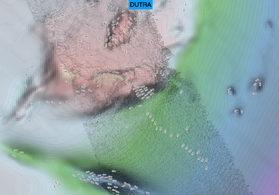
Follow 1-foot contour intervals from the beach to 500 feet, then 10-foot intervals from 500 to 2,500 feet. Read depth changes and identify structure with clearly labeled contours.
Bank Zoom Charts
Inspect ledges, ridges and depth changes with additional detail in available Bank Zoom charts. Study promising structure before your next trip.
Works Completely Offline
Download your chart once and take it anywhere. No cell service, internet connection, or offshore signal required.
Labeled Contours & Color Bands
Quickly identify depth changes with labeled contours and color-coded depth bands designed to make structure easier to read at a glance.
SeaDrift Drift Test
Test your drift before a drop. Track drift direction and speed over time to understand how wind and current are moving your boat.
Bottom Composition Overlays
Add bottom composition information to your chart in supported areas. Combine seafloor characteristics with detailed contours to evaluate where to make your next drop.
See what other charts smooth over.
Ledges, ridges, hard bottom, humps, and subtle depth changes revealed through detailed bathymetry and Bank Zoom charts.
Offshore fishing charts: Gulf, Florida & Atlantic coast
Explore your region, then purchase and download charts inside the SeaDepth app for iPhone, iPad or Android. Download before heading offshore for offline access.
Brownsville, Tx. to Grand Cheniere, La.
View coverageSabine Pass, Tx. to Mobile, Alabama
View coveragePort Fourchon, La. to Tampa, Florida
View coverageHard bottom, ledges, and springs from Tampa to the Ten Thousand Islands.
View coverageReefs, humps, and the wall — Miami to the Keys.
View coverageExplore offshore structure along Florida’s Atlantic coast with detailed depth contours. Available in the SeaDepth app.
View coverageJacksonville, Florida to Wilmington, North Carolina. Over 40,000 square miles, with Southport, Charleston, Savannah and Brunswick Bank Zoom charts.
View coverageBuilt from a need to see the bottom clearly.
I'm Buster Hawthorne, founder of SeaDepth Charts. I began building my own charts in 2016 while deep-dropping and swordfishing out of Surfside, Texas. Being colorblind made it difficult to tell peaks from holes on shaded-relief charts. My early iPad maps grew into SeaDepth, with detailed contours, clear depth labels, and custom color bands to make bottom structure easier to read.
What Captains Are Saying About SeaDepth Charts
SeaDepth merchandise — coming soon
Shirts, hats, decals, and apparel are on the way.
Ready to see your bottom in detail?
Download SeaDepth for iPhone, iPad or Android. Purchase your regional charts inside the app and download them before heading offshore.